Military aircraft Yun-9 assists earthquake relief
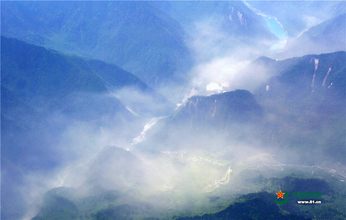
An image taken by a Yun-9 aircraft of the PLA Air Force shows the earthquake-hit area in Jiuzhaigou County, Southwest China’s Sichuan Province, Aug.9, 2017. After a four-hour flight, the transport aircraft provided the first high-resolution reconnaissance images of areas within a 20km radius of the epicenter, providing an important reference material for relief workers. [Photo: 81.cn]
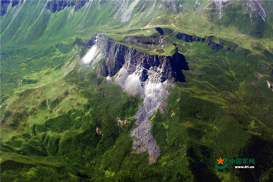
An image taken by a Yun-9 aircraft of the PLA Air Force shows the earthquake-hit area in Jiuzhaigou County, Southwest China’s Sichuan Province, Aug.9, 2017. After a four-hour flight, the transport aircraft provided the first high-resolution reconnaissance images of areas within a 20km radius of the epicenter, providing an important reference material for relief workers. [Photo: 81.cn]
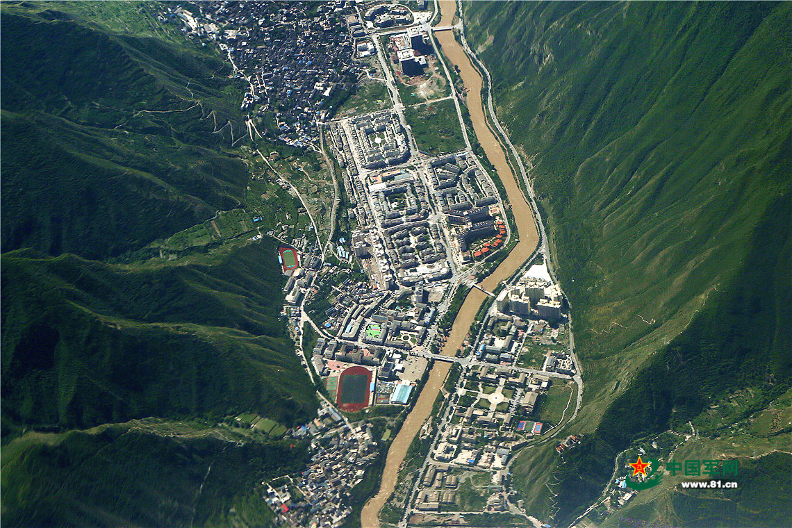
An image taken by a Yun-9 aircraft of the PLA Air Force shows the earthquake-hit area in Jiuzhaigou County, Southwest China’s Sichuan Province, Aug.9, 2017. After a four-hour flight, the transport aircraft provided the first high-resolution reconnaissance images of areas within a 20km radius of the epicenter, providing an important reference material for relief workers. [Photo: 81.cn]
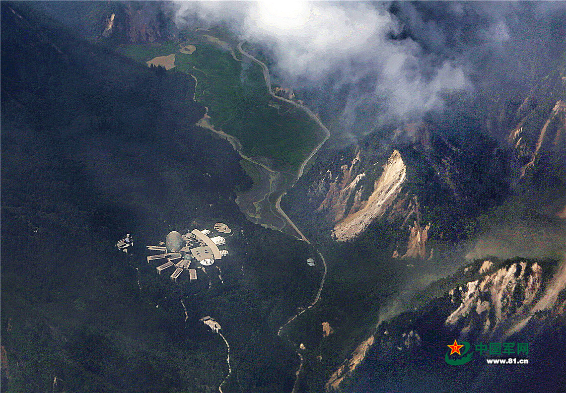
An image taken by a Yun-9 aircraft of the PLA Air Force shows the earthquake-hit area in Jiuzhaigou County, Southwest China’s Sichuan Province, Aug.9, 2017. After a four-hour flight, the transport aircraft provided the first high-resolution reconnaissance images of areas within a 20km radius of the epicenter, providing an important reference material for relief workers. [Photo: 81.cn]
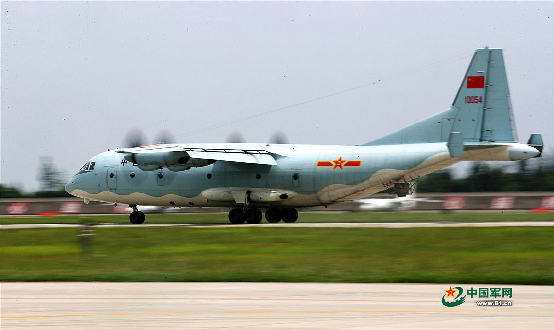
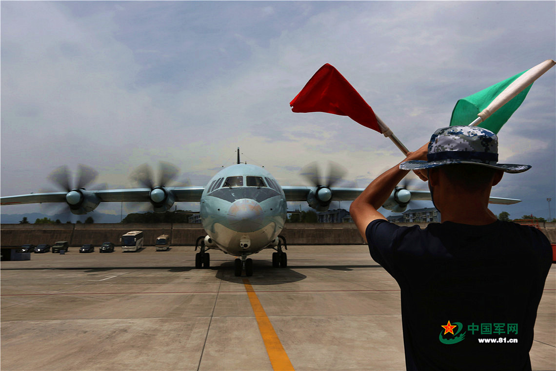
A Yun-9 aircraft of the PLA Air Force returns to its base after taking pictures of the earthquake-hit area in Jiuzhaigou County, Southwest China’s Sichuan Province, Aug.9, 2017. After a four-hour flight, the transport aircraft provided the first high-resolution reconnaissance images of areas within a 20km radius of the epicenter, providing an important reference material for relief workers. [Photo: 81.cn]
A Yun-9 aircraft of the PLA Air Force returns to its base after taking pictures of the earthquake-hit area in Jiuzhaigou County, Southwest China’s Sichuan Province, Aug.9, 2017. After a four-hour flight, the transport aircraft provided the first high-resolution reconnaissance images of areas within a 20km radius of the epicenter, providing an important reference material for relief workers. [Photo: 81.cn]
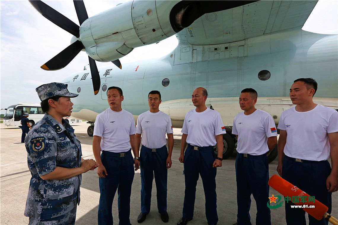
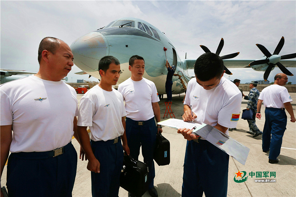
Yun-9 aircraft crew debrief after taking reconnaissance images of the earthquake-hit area in Jiuzhaigou County, Southwest China’s Sichuan Province, Aug.9, 2017. After a four-hour flight, the transport aircraft provided the first high-resolution reconnaissance images of areas within a 20km radius of the epicenter, providing an important reference material for relief workers. [Photo: 81.cn]
Yun-9 aircraft crew debrief after taking reconnaissance images of the earthquake-hit area in Jiuzhaigou County, Southwest China’s Sichuan Province, Aug.9, 2017. After a four-hour flight, the transport aircraft provided the first high-resolution reconnaissance images of areas within a 20km radius of the epicenter, providing an important reference material for relief workers. [Photo: 81.cn]